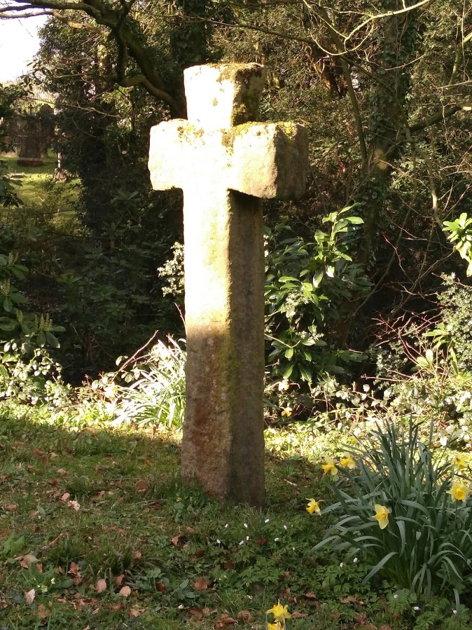
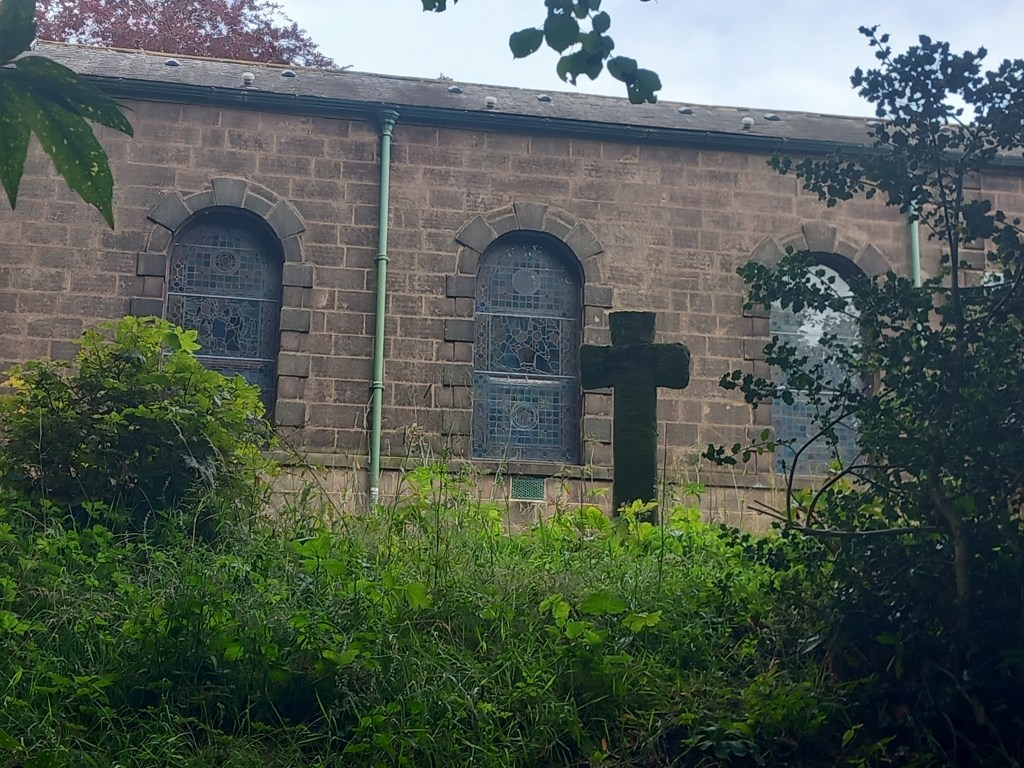
Haddock Park Cross stands just behind St Joseph’s Church, in a little garden area that overlooks the main graveyard. Its an impressively sized cross, cut from a single piece of stone. The top arm of the cross had been lost but in recent years a good repair has been made.

The name Haddock Park Wood Cross gives us a clue that it is not its original position. It is a boundary cross that once stood on the boundary line between Leyland and Blackburn Hundreds. Its position was close to Haddock Park Wood, a little over a mile away from its present position. A hundred was an administrative area that dates from Saxon times and continued to be used well into the Medieval period. (The historical definition of what a hundred is is somewhat obscure – some sources state that it was the amount of land that was required to support a hundred peasant families, or could provide a hundred ‘men-at-arms’.)
The Historic England Pastscape website states that Haddock Park Wood Cross originally “marked an angle in the boundary line between the hundreds of Blackburn and Leyland hundreds”. Looking at an Ordnance Survey map or an A-Z Street Atlas of Lancashire (a much underused resource for the history enthusiast) reveals the likely spot. At grid reference (589 254) in this vicinity, Gorton Brook and Bank Head Brook meet, as do three footpaths. This coupled with the fact there is a ford here makes it a good place for a wayside cross. Directions below give instructions of how to view the cross in its current position by St Joseph’s Church and also the site where it originally stood.
Directions to view Haddock Park Wood Cross at St Joseph’s Church, Chapel Fold, near Brindle
Grid Reference OS Maps and A-Z Street Atlas (602 265)
There is a small car park at St Joseph’s Church. Otherwise, park at Gregson Lane community centre and follow the directions below.
Gregson Lane car park is free. It is marked as ‘Recreation Ground’ on the A-Z Street Atlas map, grid reference (593 265). Turn left out of the car park, walk up Gregson Lane. When you reach a T junction, turn left into Private Road and head down it (the road is not private, that is just its name – confusingly. It is open to traffic and pedestrians).
Take the next left into the Chapel Lane. Notice the tiny remnant of Gregson Lane Cross on your right. Follow the lane down to St Joseph’s Church. The cross stands behind the church in its own fenced-off area, overlooking the graveyard. Though the gate may be closed, it usually unlocked. If it is locked, there are good views of the cross from here, and also from the graveyard below. Head down the path to the graveyard and look immediately back up towards the church to see the cross (see picture below).

Directions to the original site of the cross by Haddock Park Wood
Grid Reference for OS Maps and A-Z Street Atlas (589 254)

To see the original site of the cross, follow this route. It takes public footpaths the whole way, and these are mostly marked but you might want to take an OS map with you. The A-Z will help you get through the short walk through the streets at the beginning.
Park at Gregson Lane community centre and follow the directions below.
Gregson Lane car park is free. It is marked as ‘Recreation Ground’ on the A-Z Street Atlas map, grid reference (593 265)
Head left onto Gregson Lane. Turn right onto Alma Row. Then turn on the next left onto Alder Drive passing the Spar shop on your right.
Turn left onto Birch Crescent and follow this to the end. Now turn right onto Hayfield Avenue. Walk to the end of it where you will find a ginnel. Follow this down into the woodland. Take the public footpath that takes you over the footbridge across the stream.
Following this path will bring you out in a small orchard area of Cooper Farm – don’t worry, you are still on a public footpath. Don’t walk down the road past the farm and cottages, instead look for the footpath going into the field opposite the farm.
The footpath is clearly marked as it runs along the side of the field. You will reach a railway crossing point that is a public right of way over the train tracks. This is a busy line, so take care. Once over the tracks, continue through the next field to a very old stile. Once over this, you will see Duckworth House Farm on your right. Don’t head for the farm, instead pass over the brook and head left. Keep the hedge line on your right and you will come out into an open field with new fencing and new large metal gates. On the left hand gate you should see the small disc of a public footpath marker. Pass through the gate and follow the path until you meet a small ford.

At the ford, Haddock Park Wood lies before you. At the point you are standing, three footpaths meet by the ford over the brook. This boundary was between the Saxon Leyland Hundred and Blackburn Hundred. It is probable that the cross stood here. As the crow flies, it is not far from St Joseph’s Chapel, so it’s quite conceivable that the cross has been relocated there for safe keeping. Old crosses such as these have been knocked down and damaged during religious turmoil in the past, usually by sects of Protestant ‘reformers’. Some have been reused as bridges over streams, for example see our page on the Doffcocker Cross here.
Access
To see the cross and its former site read our extensive directions above.
Nearby
The Strange Tale of Edward Kelley at Walton-le-Dale
Walton-le-Dale’s Lost Roman Military Site
A little further away
References
The Ancient Crosses and Holy Wells of Lancashire: Volume III Blackburn Hundred, A.J. Noble (2004) North West Catholic History Society
pastscape.org.uk/hob.aspx?hob_id=43540
Comments are closed.